| WV | DHHR | BPH | OEHP | HSC | PUBLICATIONS |
 "1998 VITAL" ContentsTables PopulationBirth Death Marriage Divorce County Executive Summary |
1998 West Virginia Vital Statistics
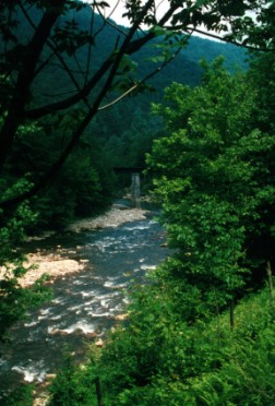
Location: Shaver's Fork of Cheat River above Bemis, Randolph County and about one and a half miles below the High Falls of Cheat. This section of the river is currently only accessable (legally) by foot (or bicycle) travel. In the center of the picture, is a bridge pier for the former Western Maryland rail line to Durbin. It is now the northern terminus of the West Fork (rail) Trail in the Monongahela National Forest. The southern terminus of the West Fork Trail is Durbin, about 23 miles south. The picture was taken from the former Western Maryland rail line that went from Elkins to Spruce, Bergoo, and Webster Springs. It is now the West Virginia Central owned by the State of West Virginia. Eventually, rail excursions will be offered on this section of the line, but due to necessary major repair work about a mile downstream, it may be a year or more before they are available. Seasonal rail excursions are offered on the Cheat Bridge to Spruce section of the line. |